
 admin
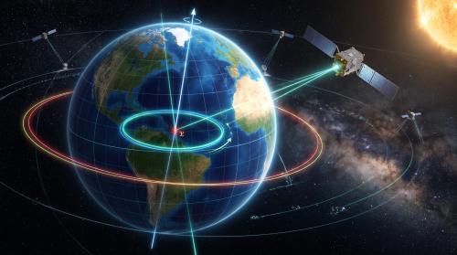
In March, snow piled across North America and Eurasia pulls Earth’s center of mass about 3 millimeters toward the North Pole. A month later, rainwater in the Amazon basin peaks at about 2,400 gigatons and pulls it 2.2 millimeters toward South America. NASA researchers now say the full yearly swing is about half as large as scientists estimated eight years ago, and the smaller number matters because that moving point anchors GPS, sea-level measurement, and mapping.
Two recent estimates disagreed by almost as much as the motion itself
Earth’s center of mass is not the same as its geometric center. Satellites orbit the center of mass, while maps and height measurements start from a fixed geometric frame. Water, ice, and air move between seasons, so the center of mass shifts by a few millimeters relative to the geometric center. The last two international estimates, made in 2017 and 2023, differed by 7 millimeters. That gap was almost as large as the motion researchers were trying to measure, which made the older numbers hard to use for precise work.
The new study, published in Geophysical Journal International and led by Donald Argus at NASA’s Jet Propulsion Laboratory, gives a tighter result. Argus said the team now estimates the yearly back-and-forth movement at about half the size believed eight years ago. In plain terms, the mass of Earth’s water and air moving between hemispheres is smaller than earlier estimates suggested. The study does not claim the motion stopped. It claims the measurement is now sharp enough to separate the motion from the error in the measurement.
Laser-tracked metal spheres could not do the job alone
The method starts with two satellites built for this exact task. LAGEOS 1 and LAGEOS 2 launched in 1976 and 1992. Each weighs 408 kilograms and carries reflective prisms. Ground stations fire lasers at them and time the return, which reveals the distance between satellite and station with high precision. Because satellites orbit the center of mass, a change in that distance can reveal a shift in the center itself.
Laser ranging alone had a structural weakness. Ground stations are not spread evenly around the planet, so some regions are tracked far better than others. The new technique adds two corrections. First, it adds GPS tracking and orbital data from several satellites in low Earth orbit, which gives a wider set of targets. Second, it accounts for crustal deformation: the weight of water and ice bends the crust, so the ground stations themselves move a small amount. Ignoring that bend would mix station motion into the center-of-mass signal.
Three loads drive the yearly pattern
The study attributes the seasonal swing to three categories: oceans, atmosphere, and continental water. Continental water includes land ice, snow, lake and river water, soil moisture, and groundwater. Each category peaks at a different time of year, which is why the center moves in a loop rather than in one direction.
Snow in North America and Eurasia reaches its maximum in March and pulls the center about 3 millimeters toward the North Pole. In April, Amazon basin rainwater peaks at 2,400 gigatons and pulls it 2.2 millimeters toward South America. Monsoon water in southeast Asia reaches 600 gigatons in November and adds a smaller pull. Between August and October, meltwater and rain swell the oceans and shift the center toward the South Pacific. The Pacific is large enough that its mass change overshadows gains and losses in smaller seas, though the Mediterranean, Red, North, Baltic, and Barents seas each add their own small shifts.
Air adds a second seasonal clock. Using a model from the European Centre for Medium-Range Weather Forecasts, the researchers found that cold, dense winter air tips the balance over Arabia, Asia, and northern Africa around December 21 each year, and over South America and South Africa around June 21. The atmosphere is light compared with water, but its mass is spread over a whole hemisphere, so the effect is measurable.
A smaller swing still changes how positions are anchored
A few millimeters sounds trivial until it is compared with the accuracy modern systems need. Felix Landerer, a coauthor at JPL, said modern positioning work relies on extremely accurate measurements, from global shipping logistics to precision agriculture. A reference frame that is off by several millimeters will carry that error into every height and position derived from it, including sea-level records that track changes of a similar size over years.
The practical gain is not a new GPS feature for phone users. It is a cleaner anchor for the reference frame that GPS, mapping agencies, and sea-level scientists share. Better reference frames reduce the chance that a change in sea level or land height is actually a change in the anchor. That distinction matters for flood planning and for tracking ice loss, where a millimeter-scale error repeated over a decade can look like a trend.
GRACE-FO gives an independent check, not a replacement
The new calculations agree with observations from GRACE Follow-On, the twin satellites launched in 2018 that map monthly changes in Earth’s gravity field as water moves above and below ground. When the lead satellite passes over a dense body, such as a swollen river basin, the extra gravitational pull changes the distance to its twin by a small but measurable amount. That agreement is useful because GRACE-FO measures gravity directly, while the new technique measures satellite orbits and station distances.
Agreement does not mean the problem is closed. The study covers seasonal swings, not every motion of the center of mass. Longer shifts from ice-sheet loss, groundwater pumping, and post-glacial rebound operate on different timescales and are not settled by one seasonal estimate. The next GRACE mission, GRACE-Continuity, is targeting a launch in late 2028 to extend a data record that is already close to 25 years long. Until that record and the new technique are compared over longer periods, the seasonal result should be read as a better annual number, not a final answer for all timescales.
What a reader should take from the October result
- The yearly swing of Earth’s center of mass is now estimated at about half the size believed eight years ago, because GPS and low-orbit satellite data were added to laser ranging and crustal bending was included.
- The 2017 and 2023 estimates differed by 7 millimeters, which shows why a tighter method was needed before the number could support precise mapping and sea-level work.
- The seasonal pattern has a clear calendar: northern snow in March, Amazon water in April, ocean swelling from August to October, and dense winter air around the solstices.
- The result improves the shared anchor for navigation and elevation, but it does not by itself resolve longer-term shifts from ice loss and groundwater change.
The open question is whether the same technique holds its accuracy when it is applied to those longer shifts. If it does, reference frames used for GPS and sea-level records will rest on a firmer point. If it does not, the seasonal correction will still help, but the longer record will need the same kind of re-examination that just halved the annual swing.
Sources
Popular Posts



Categories
Tags

Comments