
 zakialawi
In our increasingly interconnected world, the health of our planet, the earth, is a topic that weighs heavily on everyone’s minds. From dramatic shifts in weather patterns to the delicate balance of ecosystems, the signs of environmental change are undeniable. Thankfully, alongside these challenges, a powerful ally has emerged: technology. Far from being solely a source of environmental strain, innovative tech is becoming an indispensable tool in understanding, protecting, and restoring our natural world.
This isn't about distant, abstract concepts anymore. It's about practical, groundbreaking solutions that allow us to see our planet in unprecedented detail, monitor its vital signs with incredible precision, and implement targeted actions for a more sustainable future. Let's dive into how various technological advancements are revolutionizing environmental protection.
Unveiling Earth's Secrets from Above: The Power of Satellites
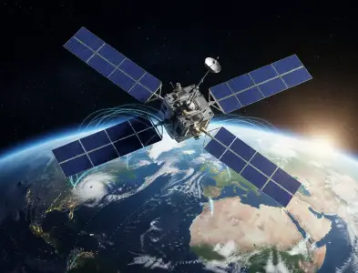
When we talk about understanding our planet on a global scale, the first technology that springs to mind is undoubtedly the satellite. These orbiting marvels are our eyes in the sky, providing continuous, comprehensive data that would be impossible to gather from the ground alone. They’ve transformed our ability to monitor everything from vast forest fires and melting ice caps to the subtle changes in ocean currents.
Think about it: a single satellite can survey enormous swaths of land and sea, capturing high-resolution imagery and specialized sensor data. This information is crucial for tracking deforestation in remote Amazonian rainforests, monitoring the health of coral reefs, or assessing the impact of natural disasters like hurricanes and floods in near real-time. This immediate insight allows for quicker response efforts and more effective planning.
Furthermore, a constellation of satellites working together provides a continuous stream of data, building an invaluable historical record of environmental changes. This long-term perspective is absolutely vital for understanding trends, predicting future scenarios, and developing effective strategies to combat issues like climate change. Without this aerial perspective, our knowledge of the global environment would be significantly fragmented.
Tracking Climate Change with Precision
The climate crisis is perhaps the most pressing environmental challenge of our time, and satellites are at the forefront of our efforts to understand and address it. They provide critical data on:
- Greenhouse Gas Emissions: Satellites equipped with advanced sensors can detect and measure concentrations of gases like carbon dioxide and methane in the atmosphere, pinpointing major sources of pollution. This helps in holding industries accountable and informing policy decisions.
- Sea Level Rise: Precisely measuring the subtle rise in global sea levels is essential for coastal communities. Satellites use radar altimetry to monitor this phenomenon with millimeter accuracy.
- Ice Sheet Dynamics: The melting of polar ice sheets is a significant contributor to sea level rise. Satellites track changes in ice thickness, volume, and flow, providing crucial data for climate models.
- Ocean Temperatures and Currents: Understanding ocean heat content and circulation patterns is key to predicting weather events and marine ecosystem health. Satellites monitor sea surface temperatures and can infer currents.
This granular data, collected consistently over years, forms the backbone of the scientific understanding that informs global climate negotiations and adaptation strategies. It’s the objective, quantifiable evidence that drives action.
Geomatics and Geodetic Science: Mapping the Earth's Foundation
Beyond orbital observations, terrestrial and near-surface technologies are equally vital. This is where fields like geomatics and geodetic science come into play. These disciplines combine surveying, mapping, and data analysis to create precise models of the Earth’s surface and its physical properties. They provide the foundational layer of understanding for many environmental initiatives.
Geomatics, for instance, encompasses technologies like Geographic Information Systems (GIS), remote sensing (which often uses satellite data but also includes aerial imagery and ground-based sensors), and global navigation satellite systems (GNSS) like GPS. GIS, in particular, is a powerful tool that allows us to visualize, analyze, and manage spatially referenced data. Environmental scientists use GIS to map pollution hotspots, track wildlife migration routes, identify areas at risk of erosion, or plan the most effective placement for renewable energy infrastructure.
Geodetic science, on the other hand, focuses on the precise measurement and representation of the Earth's shape, orientation in space, and gravitational field. High-precision GPS networks and sophisticated leveling techniques are used to monitor ground deformation, which can indicate seismic activity, volcanic unrest, or the impact of groundwater extraction. Understanding these subtle shifts in the earth’s crust is crucial for hazard assessment and resource management.
Precision Agriculture: Using Data for Sustainable Farming
One of the most impactful applications of geomatics is in precision agriculture. Farmers are increasingly leveraging GPS, sensors, and data analytics to optimize their practices. Instead of treating an entire field uniformly, they can apply water, fertilizers, and pesticides only where and when they are needed. This not only reduces waste and cost but also minimizes environmental runoff and pollution.
Sensors on tractors or drones can measure soil moisture, nutrient levels, and crop health at a very fine scale. This data, integrated into GIS, allows for variable rate applications, meaning the machinery adjusts its output based on the specific needs of different zones within a field. This leads to:
- Reduced water usage through targeted irrigation.
- Minimized fertilizer and pesticide use, preventing soil and water contamination.
- Improved crop yields, leading to more efficient land use.
- Lower energy consumption from optimized machinery operation.
This is a prime example of how sophisticated mapping and data integration contribute directly to a more sustainable use of our land resources.
Remote Sensing: Gathering Data Without Direct Contact
Remote sensing is a key component of both satellite technology and geomatics. It’s the science of obtaining information about objects or areas from a distance, typically from aircraft or satellites. This allows us to collect data on phenomena that are inaccessible, dangerous, or too vast to measure directly.
Different types of sensors are used in remote sensing, each capturing different aspects of the environment:
- Optical sensors: These capture reflected sunlight, similar to how our eyes see. They are great for identifying land cover, vegetation health, and water bodies.
- Thermal sensors: These measure infrared radiation emitted by objects, allowing us to detect temperature variations, monitor heat islands in cities, or identify stressed vegetation.
- Radar sensors: These emit microwave pulses and measure the reflected signal. Radar can penetrate clouds and work day or night, making it excellent for mapping terrain, monitoring floods, and tracking changes in ice or soil moisture.
- LiDAR (Light Detection and Ranging): This technology uses laser pulses to measure distances and create highly detailed 3D maps of the surface, including forest canopy structure and terrain features.
The data generated by these sensors provides invaluable insights into changes happening on our planet. For instance, tracking the spread of invasive species, monitoring the health of forests affected by disease, or mapping the extent of oil spills are all made possible through advanced remote sensing techniques.
Environmental Monitoring Systems
Combining data from various remote sensing platforms with ground-based sensors creates comprehensive environmental monitoring systems. These systems can track air and water quality, detect pollution sources, monitor biodiversity, and assess the impact of human activities on natural habitats. For example:
- Air Quality Monitoring: Networks of ground-based sensors, often augmented by satellite data, provide real-time information on pollutant levels in urban areas, helping to issue public health advisories and inform policy.
- Water Quality Monitoring: Satellites can track algal blooms and sediment plumes in lakes and oceans, while ground sensors can provide detailed chemical analysis of rivers and groundwater.
- Biodiversity Tracking: Acoustic sensors and camera traps, often linked to AI for automated species identification, are revolutionizing how we monitor wildlife populations and their habitats, especially in challenging terrains.
These interconnected systems offer a holistic view of environmental health, allowing for early detection of problems and the implementation of timely interventions.
Data Analytics and Artificial Intelligence: Making Sense of the Information
The sheer volume of data generated by satellites, sensors, and other technological tools is staggering. Without advanced data analytics and artificial intelligence (AI), much of this information would be unusable. These technologies are crucial for turning raw data into actionable insights.
Data analytics involves processing, cleaning, and analyzing large datasets to identify patterns, trends, and anomalies. Environmental scientists use sophisticated algorithms to model complex systems, such as atmospheric circulation, oceanographic processes, and ecosystem dynamics. This allows them to understand cause-and-effect relationships and predict future environmental conditions with greater accuracy.
Artificial intelligence (AI), particularly machine learning, is taking this a step further. AI can automate the process of identifying specific features in satellite imagery, such as distinguishing between different types of crops, identifying illegal logging activities, or detecting the presence of specific animal species. AI algorithms can also analyze vast amounts of climate data to improve the accuracy of weather forecasts and long-term climate projections.
AI for Conservation and Biodiversity Protection
AI is proving to be a game-changer in conservation efforts:
- Predictive Modeling: AI can predict areas at high risk of poaching or illegal deforestation, allowing conservationists to allocate resources more effectively for patrols and enforcement.
- Species Identification: Machine learning models can analyze camera trap images or audio recordings to automatically identify species, track their populations, and understand their behavior without extensive manual review.
- Habitat Restoration: AI can help identify optimal locations for reforestation projects and monitor the success of restoration efforts by analyzing changes in vegetation cover over time.
- Waste Management: AI-powered sorting systems are improving recycling rates by automatically identifying and separating different types of waste, reducing the amount of material sent to landfills.
These AI-driven applications are accelerating our ability to understand and protect the natural world in ways that were previously unimaginable.
Renewable Energy Technologies: Powering a Sustainable Future
While not directly involved in monitoring or data collection, advancements in renewable energy technologies are fundamental to protecting the environment. Shifting away from fossil fuels towards cleaner energy sources is essential for mitigating climate change and reducing pollution.
Solar power has seen dramatic improvements in efficiency and affordability, with innovative photovoltaic cells and energy storage solutions becoming increasingly common. Wind energy, harnessing the power of turbines, continues to expand, providing clean electricity on a massive scale.
Beyond these established technologies, exciting innovations are emerging:
- Geothermal energy: Utilizing the Earth's internal heat to generate power.
- Tidal and wave energy: Harnessing the power of ocean movements.
- Advanced battery storage: Crucial for ensuring a stable and reliable power supply from intermittent renewable sources.
- Smart grids: Technologies that optimize the distribution and consumption of electricity, integrating renewable sources seamlessly.
The continued development and adoption of these technologies are critical steps in decarbonizing our economies and reducing our reliance on polluting energy sources. This directly addresses the root causes of many environmental problems.
The Internet of Things (IoT) and Smart Cities
The Internet of Things (IoT) involves a network of connected devices that collect and exchange data. In the context of environmental protection, IoT sensors can monitor a wide range of parameters in real-time, feeding data into smart city infrastructure and environmental management systems.
Imagine smart waste bins that signal when they're full, optimizing collection routes and reducing fuel consumption. Or smart streetlights that adjust their brightness based on ambient light and pedestrian presence, saving energy. Water management systems can use IoT sensors to detect leaks in pipes, conserving precious water resources.
In smart cities, IoT plays a crucial role in:
- Traffic management: Reducing congestion and associated emissions.
- Energy efficiency: Optimizing building energy consumption.
- Pollution monitoring: Providing granular data on air and noise pollution.
- Water conservation: Detecting leaks and optimizing irrigation.
By connecting physical devices and enabling data-driven decision-making, IoT is fostering more efficient and sustainable urban environments.
Challenges and the Road Ahead
While technology offers incredible potential, it's not a magic bullet. There are significant challenges to overcome:
- Data accessibility and sharing: Ensuring that valuable environmental data is accessible to researchers, policymakers, and the public is crucial for collaborative efforts.
- Digital divide: Ensuring that developing nations and marginalized communities have access to and can benefit from these technologies.
- E-waste: The production and disposal of electronic devices themselves can have significant environmental impacts. Sustainable manufacturing and recycling practices are vital.
- Energy consumption of technology: The servers and infrastructure required to process vast amounts of data can consume substantial energy. Developing more energy-efficient computing solutions is important.
- Ethical considerations: Ensuring that data is used responsibly and ethically, particularly in areas like surveillance and resource allocation.
Despite these hurdles, the trajectory is clear: technology is becoming an increasingly indispensable partner in our quest to protect the earth. From the vast sweep of satellite imagery providing a global perspective to the granular insights offered by geomatics and AI, we are gaining unprecedented tools to understand and safeguard our environment.
Conclusion: A Technologically Empowered Future for Earth
The interplay between technology and environmental protection is dynamic and ever-evolving. We are moving beyond simply observing problems to actively developing solutions. The sophisticated insights gained from satellite monitoring, the foundational understanding provided by geomatics and geodetic science, the processing power of data analytics and AI, and the clean energy generated by technological innovation are all converging to create a more sustainable future.
For students and professionals alike, understanding these technological advancements is no longer optional; it's essential. The ability to leverage these tools effectively will be key to addressing the complex environmental challenges of our time and ensuring a healthy, thriving planet for generations to come. The future of our earth is, in many ways, intertwined with the intelligent and responsible application of technology.
Popular Posts



Categories
Tags

Comments