
 admin
admin
Unlocking 3D Reality The Power of Agisoft Metashape
In a world increasingly reliant on accurate spatial data and detailed 3D models, software like Agisoft Metashape stands out as a true game-changer. Whether you're a land surveyor, an archaeologist, a game developer, or just someone fascinated by the ability to reconstruct real-world objects and landscapes from simple photographs, understanding Agisoft Metashape is key. It's a powerful tool that transforms ordinary images into extraordinary 3D data, making complex tasks surprisingly accessible and efficient. This article will guide you through what Agisoft Metashape is, why it's so important, and how it's shaping various industries.
What is Agisoft Metashape?
Agisoft Metashape, formerly known as Agisoft PhotoScan, is a standalone software product that performs photogrammetric processing of digital images and generates 3D spatial data. In simpler terms, you feed it a set of overlapping photos of an object or an area, and it intelligently stitches them together to create highly accurate 3D models, point clouds, orthomosaics, and digital elevation models (DEMs).
The magic behind Metashape lies in its advanced photogrammetry algorithms. Photogrammetry is the science of making measurements from photographs. Metashape automates much of this complex process, allowing users to reconstruct 3D environments with remarkable detail and precision. It's widely used across various sectors for its ability to produce professional-grade results from consumer-grade cameras and even drone imagery.
Key Features of Agisoft Metashape
Metashape boasts a comprehensive suite of features that cater to a wide range of photogrammetry needs. Here are some of its core capabilities:
Photogrammetric Processing
- Image Alignment: Automatically detects common points on multiple images and aligns them to reconstruct the camera positions and orientations.
- Sparse Point Cloud Generation: Creates a preliminary, sparse point cloud representing the geometry of the scene based on aligned images.
Dense Point Cloud Generation
- Generates a dense cloud of 3D points that accurately represent the object or terrain, offering incredibly fine detail. This is often the foundation for subsequent modeling.
Orthomosaic & DEM Creation
- Orthomosaics: Produces high-resolution, geographically accurate aerial maps by stitching together multiple images, correcting for perspective and terrain distortions.
- Digital Elevation Models (DEMs): Creates digital representations of terrain surfaces, including Digital Surface Models (DSMs) and Digital Terrain Models (DTMs). These are crucial for elevation analysis.
3D Model Generation
- Builds textured 3D models from the dense point cloud, suitable for visualization, measurements, or export to other modeling software. This is often used for architectural visualization or object reconstruction.
Georeferencing & GCP Support
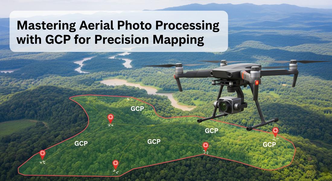
- Allows users to georeference their models and maps to real-world coordinate systems using Ground Control Points (GCPs), ensuring high spatial accuracy.
Network Processing
- Enables processing large datasets across multiple computers in a network, significantly reducing processing time for extensive projects.
Who Benefits from Agisoft Metashape?
The versatility of Agisoft Metashape makes it an invaluable tool for professionals in numerous fields:
- Surveying & Mapping Professionals: For creating accurate topographic maps, volumetric calculations, and site surveys using drone data.
- Cultural Heritage & Archaeology: To document historical sites, artifacts, and excavations in 3D, preserving them digitally for future generations.
- Architecture & Construction: For building information modeling (BIM), construction progress monitoring, and as-built documentation.
- Agriculture & Forestry: For crop health monitoring, yield prediction, forest inventory, and terrain analysis.
- Gaming & VFX: To generate realistic 3D assets and environments for video games and visual effects, speeding up the modeling process.
- Research & Education: As a powerful tool for academic studies involving spatial analysis, 3D reconstruction, and visualization.
The Agisoft Metashape Workflow: A Simplified Guide
Understanding the basic workflow within Agisoft Metashape can help you get started quickly. While the software offers many advanced options, the core process generally follows these steps:
1. Image Import & Alignment
The first step is to import your images. Metashape automatically detects and aligns them, identifying common points across overlapping photos. This creates a sparse point cloud and determines the precise location and orientation of each camera.
Tip: Ensure your images have sufficient overlap (60-80% frontlap and sidelap for aerial, more for close-range objects) and good quality for best results.
2. Sparse Point Cloud & Tie Points
After alignment, Metashape generates a sparse point cloud. This is a preliminary 3D representation of your scene. At this stage, you can add Ground Control Points (GCPs) if you need to georeference your model to real-world coordinates for high accuracy.
3. Dense Point Cloud Generation
Based on the sparse point cloud, Metashape then computes a much denser point cloud. This step is computationally intensive but results in a highly detailed and accurate representation of the object or terrain. You can adjust quality settings here to balance detail with processing time.
4. Mesh/3D Model Generation
From the dense point cloud, Metashape can generate a 3D mesh (a surface model composed of triangles). This mesh forms the geometric base for your 3D model.
5. Texture Mapping
Once the mesh is created, Metashape projects the original image textures onto the mesh, creating a visually realistic 3D model. This is where your model truly comes to life.
6. Orthomosaic & DEM Export
For aerial mapping projects, you can then generate orthomosaics and Digital Elevation Models (DEMs). These are highly accurate, georeferenced 2D products essential for mapping, planning, and analysis. Finally, you can export your results in various industry-standard formats (e.g., OBJ, PLY, DXF, TIFF, LAS).
Common Challenges and How to Overcome Them
While Agisoft Metashape is incredibly powerful, users can sometimes encounter challenges. Here are a few common ones and how to tackle them:
Processing Time & Hardware Requirements
Challenge: Processing large datasets can take a very long time, especially on underpowered hardware.
Solution: Metashape is CPU and GPU intensive. Ensure you have a powerful multi-core processor, a substantial amount of RAM (32GB or more is recommended for large projects), and a dedicated, high-end NVIDIA GPU. Utilize network processing if you have multiple machines. For very large projects, consider processing in smaller chunks.
Image Quality & Overlap
Challenge: Poor image alignment or holes in the model due to insufficient image quality or inadequate overlap.
Solution: Always capture high-resolution, sharp images with consistent lighting. Ensure significant overlap (60-80% minimum, often more for complex objects or terrain). Avoid blurry images, glare, or highly reflective surfaces. Calibrate your camera if necessary, or let Metashape perform self-calibration.
Georeferencing Accuracy
Challenge: Inaccurate georeferencing when trying to align the model to real-world coordinates.
Solution: Use accurate Ground Control Points (GCPs) measured with a high-precision GPS or total station. Distribute GCPs evenly across your project area, ensuring some are visible in multiple images. Mark GCPs precisely within Metashape's interface.
Understanding Parameters
Challenge: The multitude of processing parameters can be overwhelming, leading to suboptimal results.
Solution: Start with default settings, then experiment. Read the Metashape manual or online tutorials for specific parameter explanations. Understand the trade-offs between "High" quality settings (more detail, longer processing) and "Low" (less detail, faster processing). Focus on one parameter at a time to see its effect.
Tips for Optimizing Your Agisoft Metashape Projects
To get the most out of Agisoft Metashape and ensure successful projects, consider these practical tips:
- Invest in Good Hardware: As mentioned, a powerful computer is your best friend. Prioritize RAM and a high-end GPU.
- Capture High-Quality Imagery: The output quality of Metashape is directly proportional to the input image quality. Use a good camera, ensure proper lighting, and maintain consistent camera settings (ISO, aperture, shutter speed) throughout your capture.
- Master GCPs: For highly accurate, georeferenced models, Ground Control Points are indispensable. Plan their placement carefully and measure them accurately.
- Experiment with Settings: Don't be afraid to try different processing parameters. Sometimes, a slight tweak can dramatically improve results or reduce processing time. Start with the default settings and adjust incrementally.
- Process in Chunks (for large areas): If you're mapping a vast area, consider breaking it into smaller, manageable chunks for processing, then seamlessly stitching them together later.
- Utilize Masks: For complex objects, using masks (manual or smart masks) can help the software focus only on the relevant parts, improving alignment and model quality while reducing noise.
- Stay Updated: Agisoft regularly releases updates with new features, bug fixes, and performance improvements. Keep your software updated to leverage the latest advancements.
Download Metashape Pro Full Version 64 Bit
Password: www.yasir252.com
How to Install Metashape Pro Full Version 64 Bit
- Download Metashape Pro Full Version for Windows
- Before extracting, turn off Antivirus and Disable Windows Defender
- Run setup.exe and install the application
- Then run the BlockFakeSite.cmd file (run as admin)
- For 64 Bit: Copy 2 files in the Crack folder > Paste and Replace in "C:\Program Files\Agisoft\Metashape Pro\"
- For 32-bit: Follow the instructions in readme.txt
- For Mac & Linux: Follow the instructions in readme.txt
- Enjoy!
Conclusion
Agisoft Metashape is an incredibly versatile and powerful tool that has revolutionized the field of photogrammetry and 3D reconstruction. From precise mapping and surveying to creating stunning 3D models for cultural heritage and entertainment, its capabilities are vast. By understanding its core features, workflow, and common challenges, you can unlock the full potential of this software to transform your images into accurate and detailed 3D realities. Start exploring its functionalities today and witness the seamless transition from pixels to precise spatial data.
Ready to try Agisoft Metashape yourself? You can download a trial version or purchase the full license from the official Agisoft website:
Share your own tips for using Agisoft Metashape in the comments section below!
Popular Posts



Categories

Comments